

Introduction
If you live in Jaipur, commute daily, or are planning to buy property on the western side of the city, chances are you’ve heard the name — 200 Feet Bypass Road Jaipur.
This road is one of the most important arterial roads in Jaipur’s expanding western corridor. It connects key residential zones like Mansarovar, Vaishali Nagar, and Sodala with the Ajmer Highway (NH-48), making it a lifeline for thousands of daily commuters, truck drivers, and travellers.
But what exactly is 200 Feet Bypass Road? Where does it start and end? What’s near it? And why has it become such a hotspot for real estate development?
This guide answers all those questions — with distances, landmarks, transport options, and practical travel tips you can actually use.
What is 200 Feet Bypass Road Jaipur?
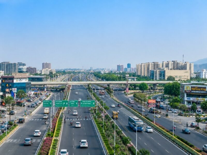
200 Feet Bypass Road Jaipur (also called 200 Feet Bypass Ajmer Road) is a wide arterial road located in the western part of Jaipur city. It runs roughly parallel to — and eventually merges with — Ajmer Road (NH-48), forming a critical bypass for traffic coming from or going toward Ajmer, Kishangarh, and beyond.
Quick Definition: 200 Feet Bypass Road is a 60-metre (approximately 200 feet) wide road in west Jaipur, designed to ease traffic on Ajmer Road by routing heavy and bypass traffic away from congested city areas.
This road passes through or near key localities including Bhankrota, Mansarovar Extension, Pratap Nagar, and connects to the Jaipur Ring Road network. It is actively used by:
- Long-distance freight trucks heading toward NH-48
- Daily commuters travelling between western Jaipur suburbs and the city centre
- Residents of newer housing colonies in the western corridor
- Travellers heading to Ajmer, Pushkar, or Mumbai via road
Why is it Called 200 Feet Road?
The name “200 Feet Road” comes directly from its road width. The Jaipur Development Authority (JDA) planned this road with a Right-of-Way (RoW) of approximately 60 metres, which equals roughly 200 feet.
In Indian urban planning, roads are often nicknamed based on their width — you’ll find “100 Feet Road,” “80 Feet Road,” and “200 Feet Road” in many cities. Jaipur’s 200 Feet Bypass Road is one of the widest planned roads in the city, designed specifically to handle high traffic volume and future urban expansion.
The wide road design also allows for:
- Dedicated service lanes on either side
- Space for future metro rail or BRT corridors
- Footpaths and green buffer zones
- Planned commercial development along the frontage
Exact Location
200 Feet Bypass Road is located in the western zone of Jaipur, in Rajasthan, India.
- Starting Point (approx.): Near Bhankrota Chauraha / NH-48 Junction on Ajmer Road
- Ending Point (approx.): Connects toward Mansarovar, Pratap Nagar, and the broader ring road network
- Administrative Zone: Jaipur Development Authority (JDA) Zone, Jaipur Municipal Corporation (JMC) limits
- PIN Code Areas Covered: 302020 (Bhankrota), 302011 (Mansarovar), 302021 (Vaishali Nagar vicinity)
On Google Maps, you can search “200 Feet Bypass Road Jaipur” and it shows up as a distinct road corridor in the Bhankrota–Mansarovar stretch.
Route Map Overview
The 200 Feet Bypass Road broadly follows this corridor:
NH-48 / Ajmer Highway → Bhankrota Chauraha → 200 Feet Bypass Road → Mansarovar Extension → Pratap Nagar → Inner Jaipur Ring Road
Key intersections and junctions along the route:
| Junction / Point | Area |
|---|---|
| Bhankrota Chauraha | Entry from NH-48 / Ajmer Road |
| Rajasthan Patrika Office Crossing | Mid-section commercial zone |
| Mansarovar Extension Circle | Residential hub intersection |
| Pratap Nagar Crossing | South–west Jaipur connector |
| Ring Road Junction | Connects to Jaipur Ring Road |
Distance from Major Jaipur Locations
Here are approximate distances to 200 Feet Bypass Road (Bhankrota end) from key locations in Jaipur:
| Location | Distance (approx.) | Travel Time (normal traffic) |
|---|---|---|
| Jaipur Railway Station | 14–16 km | 30–40 minutes |
| Jaipur International Airport | 6–8 km | 15–25 minutes |
| Sindhi Camp Bus Stand | 13–15 km | 30–40 minutes |
| Mansarovar Metro Station | 3–5 km | 10–15 minutes |
| Vaishali Nagar | 4–6 km | 12–18 minutes |
| Sodala | 7–9 km | 18–25 minutes |
| MI Road / City Centre | 16–18 km | 35–50 minutes |
| Hawa Mahal | 18–20 km | 40–55 minutes |
| Ajmer City | ~130 km | 2–2.5 hours |
| Kishangarh | ~90 km | 1.5–2 hours |
Note: Travel times vary significantly based on traffic, time of day, and road conditions. Always check Google Maps for live estimates.
Connectivity with Ajmer Road
One of the biggest advantages of 200 Feet Bypass Road is its direct link with Ajmer Road (NH-48) — one of India’s busiest national highways.
NH-48 connects Jaipur with Delhi (via NH-48/NH-48 corridor), Ajmer, Kishangarh, and eventually Mumbai. The bypass road allows vehicles travelling on NH-48 to:
- Avoid entering the congested inner city
- Access western Jaipur localities directly
- Connect to the Ring Road without passing through Sodala or Tonk Road traffic
This is especially useful for:
- Commercial vehicles (trucks, buses) that need to bypass the city
- Daily commuters from Bhankrota, Kalwar Road, and Mansarovar Extension areas
- Travellers arriving from Ajmer or Delhi who want to reach the western suburbs directly
The junction at Bhankrota Chauraha is the key node where Ajmer Road and 200 Feet Bypass Road meet. It also has a flyover that reduces signal stops for through-traffic.
Nearby Residential Areas
The 200 Feet Bypass Road corridor has rapidly become one of Jaipur’s most desirable residential zones. Here are the main areas nearby:
| Residential Area | Distance from 200 Feet Road | Known For |
|---|---|---|
| Mansarovar | 3–5 km | Large planned township, metro station |
| Vaishali Nagar | 4–7 km | Premium housing, markets |
| Pratap Nagar | 1–3 km | Affordable housing, growing locality |
| Bhankrota | 0–2 km | Entry point, mixed residential |
| Shyam Nagar | 5–7 km | Established residential area |
| Chitrakoot | 6–8 km | Family-friendly, good amenities |
| Mansarovar Extension | 2–4 km | New housing colonies, open plots |
| Ajmer Road Colonies | 1–4 km | Road-facing residential plots |
Nearby Commercial Areas
The road has attracted significant commercial activity, particularly in the Bhankrota and Mansarovar Extension stretch:
- Bhankrota Commercial Zone – Workshops, warehouses, fuel stations
- Mansarovar Plaza – Retail and service markets
- Showroom Strip on Ajmer Road – Car dealerships, furniture showrooms, electronics
- Industrial & Logistics Area – Small manufacturing units and godowns near NH-48
- IT & Office Clusters – Emerging near Pratap Nagar and Mansarovar Extension
Nearby Schools
Families considering this area will find several reputed schools in close proximity:
| School Name | Approximate Distance | Board |
|---|---|---|
| Seedling Modern High School | 3–5 km | CBSE |
| Maheshwari Public School, Mansarovar | 4–6 km | CBSE |
| St. Xavier’s School, Mansarovar | 5–7 km | ICSE |
| Delhi Public School, Jaipur | 8–10 km | CBSE |
| Rajmata Krishna Kumari Girls’ School | 6–8 km | RBSE / CBSE |
| The Fabindia School (Ajmer Road direction) | 12–15 km | CBSE |
Always verify school distances via Google Maps before finalizing a location decision.
Nearby Hospitals
Medical facilities are well-distributed around the 200 Feet Bypass Road corridor:
| Hospital | Approximate Distance | Specialty |
|---|---|---|
| Manipal Hospital Jaipur | 5–7 km | Multi-specialty |
| Eternal Hospital, Mansarovar | 3–5 km | Multi-specialty |
| Apex Hospital, Mansarovar | 4–5 km | Cardiac & Multi-specialty |
| Narayana Multispeciality Hospital | 8–10 km | Multi-specialty |
| Government Mahila Chikitsalay | 12–14 km | Gynecology & General |
| Fortis Escorts Hospital | 14–16 km | Cardiac & Trauma |
For emergencies, Apex Hospital and Eternal Hospital in Mansarovar are the closest major facilities to this road.
Nearby Hotels
Travellers and visitors have good hotel options near 200 Feet Bypass Road and the Ajmer Road corridor:
| Hotel | Category | Approximate Distance |
|---|---|---|
| Hotel Arya Niwas (Ajmer Road end) | Budget | 12–14 km |
| Lemon Tree Hotel, Jaipur | Mid-range | 10–12 km |
| Fairfield by Marriott (Ajmer Road) | Premium | 8–10 km |
| The Muse Sarovar Portico | Mid-range | 5–8 km |
| Hotel Sarovar Portico, Ajmer Road | Mid-range | 7–10 km |
Most premium hotel options are concentrated on the main Ajmer Road stretch. Budget travellers can find guesthouses and homestays in Mansarovar and Vaishali Nagar.
Nearby Shopping Malls
Shopping and entertainment options near 200 Feet Bypass Road:
| Mall / Market | Approximate Distance | Key Stores |
|---|---|---|
| Triton Mall, Ajmer Road | 8–10 km | Anchor stores, multiplex |
| Mansarovar Shopping Centre | 3–5 km | Daily shopping, eateries |
| V3S Mall (if applicable) | 6–8 km | Retail and food court |
| Vaishali Nagar Market | 5–7 km | Local shopping hub |
| World Trade Park, MI Road | 15–17 km | Premium retail, fine dining |
Metro Connectivity
The Jaipur Metro currently covers Phase 1 and Phase 2 of its planned network. Here’s how 200 Feet Bypass Road connects to metro stations:
| Metro Station | Distance from 200 Feet Road | Line |
|---|---|---|
| Mansarovar Station | 3–5 km | Pink Line (Phase 1B) |
| New Aatish Market | 6–8 km | Pink Line |
| Vivek Vihar | 7–9 km | Pink Line |
| Sindhi Camp | 13–15 km | Purple Line (Phase 1A) |
Important: As of 2025, no metro station exists directly on or beside 200 Feet Bypass Road. The nearest operational station is Mansarovar, from where autos, e-rickshaws, and city buses connect to this road.
The proposed Jaipur Metro Phase 2 extension may bring a metro corridor closer to the Bhankrota–Ajmer Road area in future years.
Public Transport Options
Getting to and from 200 Feet Bypass Road via public transport:
Bus Routes
| Route | From | To | Passes Near |
|---|---|---|---|
| RSRTC State Bus | Sindhi Camp | Ajmer | Bhankrota on Ajmer Road |
| City Bus | Mansarovar | Chandpole | Passes near 200 Feet area |
| Private Mini-bus | Various | Bhankrota | Bhankrota Chauraha |
Other Options
- Auto-rickshaws – Available from Bhankrota Chauraha and Mansarovar
- E-rickshaws – Common in Mansarovar Extension and nearby colonies
- Cab Services (Ola/Uber) – Available across the entire corridor
- Jaipur City Transport Buses – Check JCTSL routes for current bus numbers
For live bus route information, check the JCTSL (Jaipur City Transport Services Limited) official app or website.
Traffic Conditions
Like most major bypass roads in Indian cities, 200 Feet Bypass Road has predictable traffic patterns:
Peak Hours (Heavy Traffic):
- Morning: 8:00 AM – 10:30 AM
- Evening: 5:30 PM – 8:30 PM
Light Traffic Hours:
- Mid-day: 11:00 AM – 4:00 PM
- Early morning: Before 7:30 AM
- Late night: After 9:30 PM
Traffic Hot Spots:
- Bhankrota Chauraha – Busiest intersection, especially during peak hours
- Mansarovar Extension Crossing – Moderate congestion
- Near school zones – Heavy during 7:30–9:00 AM and 1:30–3:00 PM
Heavy vehicles (trucks, trailers) are permitted on this road but are typically more active in early morning and late evening hours. The Bhankrota flyover helps manage through-traffic significantly.
Best Time to Travel
| Purpose | Best Time | Why |
|---|---|---|
| Daily commute | Before 8 AM or after 9 PM | Avoid peak congestion |
| Visiting facilities nearby | 10 AM – 4 PM | Comfortable, light traffic |
| Intercity travel via NH-48 | Early morning (5–7 AM) | Smooth highway access |
| Weekend errands | Saturday morning | Relatively light traffic |
| Shopping trip | Weekday afternoon | Malls less crowded |
Google Maps Navigation Tips
Getting accurate directions on 200 Feet Bypass Road is easy if you know what to search:
- Search “200 Feet Bypass Road Jaipur” or “200 Feet Bypass Ajmer Road” on Google Maps
- Use “Bhankrota Chauraha Jaipur” as a landmark for the Ajmer Road junction end
- For the Mansarovar side, search “Mansarovar Metro Station” and navigate from there
- Enable Live Traffic view (the coloured overlay) before starting your journey
- Set “Avoid Tolls” if you want to stay on city roads instead of NH-48 segments
- Use Street View to identify key intersections before an unfamiliar journey
- Save key locations (hospital, school, office) as Saved Places for faster daily navigation
Offline tip: Download the Jaipur map offline in Google Maps before driving through areas with patchy signal.
Major Landmarks Along the Route
| Landmark | Location on Route | Type |
|---|---|---|
| Bhankrota Flyover | Bhankrota Chauraha | Infrastructure |
| Rajasthan Patrika Office | Mid-section | Media / Office |
| Mansarovar Metro Station | Near Mansarovar end | Transport Hub |
| Petrol Pumps (HP, Indian Oil) | Multiple points | Fuel Station |
| Mahadev Temple, Bhankrota | Bhankrota side | Religious |
| Commercial Complexes | Along the road | Retail / Office |
| RSRTC Bus Stops | At key intersections | Public Transport |
| Police Chowki | Multiple locations | Civic Administration |
Real Estate Growth Around 200 Feet Road
The 200 Feet Bypass Road corridor has seen significant real estate appreciation over the last 5–7 years, driven by:
- Improved road infrastructure and flyovers
- Growing residential demand in Mansarovar Extension and Pratap Nagar
- Proximity to NH-48 (a major investment draw for commercial properties)
- JDA-approved plotted colonies in the western belt
Real Estate Snapshot (Approximate 2025 Market Rates)
| Property Type | Location on/near Road | Approx. Rate (₹/sq ft) |
|---|---|---|
| Residential Plot | Mansarovar Extension | ₹3,500 – ₹6,000 |
| Residential Flat | Pratap Nagar | ₹3,000 – ₹5,000 |
| Commercial Shop | Bhankrota Road-facing | ₹7,000 – ₹15,000 |
| Agricultural / Residential Land | Bhankrota Outskirts | ₹2,000 – ₹4,000 |
| Builder Floor | Mansarovar Extension | ₹4,000 – ₹7,000 |
Disclaimer: Property rates are approximate and based on general market data. Always consult a registered property dealer or RERA-listed agent for accurate current rates.
Key real estate drivers in this area:
- JDA-planned sectors with proper layouts and civic amenities
- Commercial frontage on 200 Feet Road attracts showrooms, retail outlets
- Connectivity premium — being close to both NH-48 and city roads adds value
- New housing projects by established Jaipur developers
Future Infrastructure Projects
The western corridor of Jaipur — where 200 Feet Bypass Road is located — has several planned and ongoing infrastructure upgrades:
- Jaipur Metro Phase 2 Extension: Proposed to extend metro connectivity toward the Ajmer Road corridor, which may include stations near or along this belt in coming years
- Ring Road Completion: The Jaipur Ring Road project, managed by NHAI, aims to complete missing stretches that will further integrate 200 Feet Bypass Road with the city’s outer ring
- Road Widening & Dividers: JDA has periodically undertaken widening and beautification of this corridor, including median plantation and service road development
- Footpath & Cycle Track: Smart City Mission proposals include non-motorised transport infrastructure on key arterial roads
- Commercial & IT Zone Development: The western zone has been earmarked for light industrial, commercial, and IT park development by Rajasthan Industrial and Investment Corporation (RIICO) and JDA
These projects are expected to further enhance property values and commute quality along the 200 Feet Bypass Road corridor over the next 5–10 years.
Frequently Asked Questions
Q1. Where exactly is 200 Feet Bypass Road in Jaipur?
200 Feet Bypass Road is in the western part of Jaipur, running through Bhankrota and connecting to the Mansarovar–Pratap Nagar corridor. It begins near Bhankrota Chauraha on NH-48 (Ajmer Road) and extends toward the inner western suburbs of Jaipur.
Q2. Why is the road called “200 Feet Road”?
The road is named after its planned width of approximately 200 feet (60 metres), as designated by the Jaipur Development Authority (JDA). In Indian urban planning, roads are commonly referred to by their width as a way to distinguish major arterial roads from smaller ones.
Q3. How far is 200 Feet Bypass Road from Jaipur Airport?
200 Feet Bypass Road (Bhankrota end) is approximately 6–8 km from Jaipur International Airport (Sanganer). The travel time is typically 15–25 minutes depending on traffic.
Q4. Is 200 Feet Bypass Road the same as Ajmer Road?
No. 200 Feet Bypass Road runs parallel to and in conjunction with Ajmer Road (NH-48), but it is a separate road. It acts as a bypass/service road that diverts traffic away from congested sections of the main Ajmer Road.
Q5. Which metro station is closest to 200 Feet Bypass Road?
The closest operational metro station is Mansarovar Metro Station, approximately 3–5 km from the main stretch of 200 Feet Bypass Road. From there, you can take an auto-rickshaw or e-rickshaw to reach the road.
Q6. What are the major landmarks on 200 Feet Bypass Road?
Key landmarks include Bhankrota Chauraha (flyover), Rajasthan Patrika Office, Mansarovar Extension residential zones, multiple petrol pumps, commercial complexes, and connections to Pratap Nagar. Several schools and hospitals are also within 3–7 km.
Q7. What is the best route from Jaipur Railway Station to 200 Feet Bypass Road?
From Jaipur Railway Station, the most common route is: Station Road → Tonk Road → Sodala → Mansarovar → 200 Feet Bypass Road. Distance is approximately 14–16 km and takes 30–45 minutes by road.
Q8. Is there a flyover on 200 Feet Bypass Road?
Yes. The Bhankrota Flyover at Bhankrota Chauraha is a significant infrastructure feature on this corridor. It allows through-traffic (especially vehicles on NH-48) to bypass the busy junction without stopping at signals.
Q9. Is 200 Feet Bypass Road good for property investment?
The area around 200 Feet Bypass Road is considered a growth corridor. With improving infrastructure, proximity to NH-48, and JDA-planned development, property values have seen consistent appreciation. However, always consult a RERA-registered agent and verify documents before investing.
Q10. What are the peak traffic hours on 200 Feet Bypass Road?
Peak traffic is typically between 8:00 AM – 10:30 AM in the morning and 5:30 PM – 8:30 PM in the evening. Mid-day (11 AM – 4 PM) and early morning (before 7:30 AM) are the best times for smooth travel.
Q11. Are there hospitals near 200 Feet Bypass Road Jaipur?
Yes. Several hospitals are within reach, including Eternal Hospital (3–5 km), Apex Hospital in Mansarovar (4–5 km), and Manipal Hospital Jaipur (5–7 km). These are well-equipped multi-specialty hospitals.
Q12. How does 200 Feet Bypass Road connect to Jaipur Ring Road?
200 Feet Bypass Road connects to the Jaipur Ring Road at a junction toward Pratap Nagar and further south. This ring road connection allows vehicles to bypass the inner city entirely and reach other parts of Jaipur — including Agra Road, Tonk Road, and Delhi Road — without entering congested areas.
Q13. Is Google Maps accurate for 200 Feet Bypass Road navigation?
Yes, Google Maps is generally reliable for this area. Search “200 Feet Bypass Road Jaipur” or use “Bhankrota Chauraha” as your landmark. Enable live traffic for the most accurate travel time estimates.
Q14. What public transport options are available to reach 200 Feet Bypass Road?
You can reach this road via RSRTC state buses (Ajmer Road route), JCTSL city buses, auto-rickshaws from Mansarovar Metro Station, e-rickshaws from nearby localities, or cab services like Ola and Uber. Shared autos also operate from Bhankrota Chauraha.
Must Read: Rajiv Chowk Flyover Gurgaon: Latest Update, Project Details & Traffic Guide
Conclusion
200 Feet Bypass Road Jaipur is much more than just a wide stretch of asphalt. It is the backbone of western Jaipur’s urban growth — connecting thousands of residents to jobs, schools, hospitals, and the national highway network every single day.
Whether you’re a daily commuter looking for the best route, a family scouting for a new home, a business owner evaluating a commercial location, or a traveller passing through Jaipur on Ajmer Road — understanding this road helps you make smarter decisions.
The corridor is evolving fast. With metro extensions planned, ring road completion underway, and residential development accelerating, the 200 Feet Bypass Road area is set to become even more central to Jaipur’s urban story in the coming decade.
